Monday, July 23, 2007

Day ∞ - The Aftermath

The three most important attributes for a mountaineer are

1 - High pain threshold
2 - Bad memory
3 - I forget the third


They also say that we tend to idealize our dramatic experiences, looking back on them thinking something to the effect of - "wow, that wasn't so bad, maybe I'll go do something like that again...", and the more extreme the experience, the more we sugarcoat it in our memories. I have definitely found myself doing this with the Liberty Ridge experience, and the ironic part is, when I was on the climb, freezing, exhausted, and pissed off, I remember thinking - "Bloody Hell, this is really, really crappy, but you know what? I'll probably look back on it and somehow be able to convince myself that it wasn't so bad." Touché, past self predicting actions of future self. I probably will climb some big mountains again. We'll see.

It was extremely surreal getting re-acquainted with society, enjoying the unlimited access to food, water, shelter and warmth. I missed my originally scheduled flight back to Juneau, so I had to reschedule it for Monday night instead of Sunday night, giving me an extra day to hang out in Seattle. I had to return some gear to Dan at his office at REI, and while I was in the store, had the out-of-body experience of overhearing two random REI employees talk about the climb, saying that "Dan, Hooman and some other guy almost died on Mt. Rainier" and went on to discuss the whole incident while I, "some other guy" stood mere inches away, inspecting headlamps and trying not to bust out laughing.

It only took a few days for me to lose the sense of removal from the day-to-day world that I experienced after the climb. It's something I'd like to find again.

---------------------------------------------------------------------------

Breakdown by Numbers

# of Feet Ascended -
9700+ feet

# of days we were late for our return date registered with the climbing rangers -
3 days late - if the cell phone hadn't worked, there probably would have been a search and rescue operation underway by the time we got to Camp Shurman

# of Pounds lost by Jared in 6 days -
11.5 lbs

# of Crampon Points Broke during the trip -
1 Heel Point, thankfully not that critical on this route

# of Holes in Sleeping Bag -
3 - all small and fixable

# of consecutive days wearing contact lenses (without taking them out at night...) -5 days, would have been all 6 days of the trip, but they froze solid and fell out of my eyes during the blizzard on the summit

# of Blue Bags used and carried off the mountain to Camp Shurman -
4 total, 8 if you count the "double-bagging" method that Dan and I both utilized

# of successful cell phone calls from above 9,000 feet -
4 - gotta love the Motorola RAZR - yeah, they're ubiquitous and somewhat annoying, but the thing works!


# of pieces of gear lost to wind on trip -
3 - Dan's sitting pad, Hooman's sleeping bag, and one of my glove liners.

For my fellow gear dorks out there, I've posted a thorough
gear list and review here for your enjoyment. I'll spare the rest of you.


"A man does not climb a mountain without bringing some of it away with him and leaving something of himself upon it." — Martin Conway.

Saturday, July 21, 2007

Day 7 - Down off the Mountain, Home to Seattle

June 17, 2007

Emmons Glacier Crevasse Bivy Site (approx 10,000 feet) to Seattle via Camp Shurman (9,500 feet) and Glacier Basin (6,200 feet)

We wake in the morning to more snow covering our sleeping bags and gear, and sunlight streaming into our crevasse. We quickly pack, and I climb out of the crevasse, which turns out to be surprisingly easy after clearing away the loose snow that had prevented an easy exit the night before. The coil in the end of the rope has lodged itself in snow on the lip of the cliff, thankfully only feet above our crevasse, so I quickly climb around, dislodge it and drop it down to Dan in the crevasse. While waiting for Dan, I look around and notice a large group of people starting the ascent from Camp Shurman. Dan finishes packing, I haul our packs up out of the crevasse on the rope, and Dan ascends up into the sunlight and relentless wind. I scamper up to the top of our rappel rope, disassemble the anchor, and down-climb back to Dan. We immediately rope up, and haul ass down the glacier, easily navigating around crevasses in the bright sun.

Dan Descending Emmons Glacier, Guided Climbing Group in Distance Near Our Crevasse Bivy Site

With no sign of Hooman so far, we’re starting to get a bit worried, but then we meet up with the group of climbers coming up the glacier. This team turns out to be a group of guided climbers, and not only have they been informed of our situation by the rangers, they saw Hooman descending to Camp Shurman earlier that morning. Dan and I are indescribably relieved, and we continue descending the route, passing the solid snow-walled large group camping areas on Emmons Flats. When we finally arrive at the bomb-shelter of a ranger hut at Camp Shurman, Hooman comes out to greet us, looking none the worse for wear, except for some apparent frostbite on his nose. He tells us about his night.

Hooman’s Story
Thru some miscommunication, or just because we were all beyond exhaustion and not thinking straight, Hooman kept going as Dan and I were in the process of establishing our crevasse camp. Even after hearing me yelling, whistling and seeing the light of my headlamp, he continued down the glacier in the dark with the intention of reaching Camp Shurman that night if possible. He hiked until around 1:00 in the morning, at which point he decided to sit down on the glacier and wait out the night. Fully exposed to the wind and snow, he anchored himself onto a 30 degree ice slope with an ice screw, and sat down to wait for daylight. At around 2:00 – 2:30, he stood up to answer the call of nature, and as he sat back down, he realized that the tether that he had tied his sleeping bag to the anchor with had snapped, and the bag had blown away. He saw the dark outline of the bag sitting on the edge of a crevasse in the distance, and as he got up to go retrieve it, the wind took it and sent it out of sight into the crevasse. Without a rope, he couldn’t really safely expect to retrieve it from the crevasse, so he sat back down, and hunkered down for the next few hours, waiting until it got light. Finally, it got light out, and he headed down the glacier towards Camp Shurman, and reached it in the early morning, waking the ranger up and informing him that Dan and I were still up on the glacier. The exposed bivy left him with a bad case of sun and wind burn on his nose, but he was otherwise intact.

Photo of Maurice Herzog looking haggard after his Famous Epic Climb of Annapurna, taped up in Camp Shurman Ranger Hut. We could relate...

Dan and I finally caught up to him several hours at Camp Shurman later, and after a joyful reunion, we re-hydrated with what we all agreed was the best water we had ever tasted, melted and filtered courtesy of Jeremy, the climbing ranger staffing Camp Shurman. Camp Shurman itself was perched on what can only be described as one of the most astounding pieces of real estate that I have ever seen, an exposed triangle of exposed rock with sweeping 300 degree views of the Emmons and Winthrop glaciers, the Russell Cliffs above the Winthrop, Little Tahoma (a sub-peak of Mt Rainier and itself the 3rd highest peak in WA), and soaring cliffs behind the camp. After a phone call to the family to let them know I was alright, we packed up again, thanked Jeremy profusely for the water and conversation, and headed towards Glacier Basin camp to retrieve our tent.

Entertainment Cabinet at Shurman Ranger Hut

After a quick hike with lots of downhill slogging thru comfortable cushy wet snow, we arrived at our tent site, where we had been warned to expect an angry lecture about taking up tent space real estate for extended periods of time from one of the wilderness rangers. After apologizing profusely, we packed up and continued down to the parking lot, another couple of hours down the trail. Midway down the trail, the can of Red Bull that I had been saving for some extra energy on the descent fell out of my jacket where I had been thawing it, hit a sharp rock, and started spraying everywhere, so I was forced to shotgun the entire can of precious caffeinated liquid, which was, to my dehydrated system, the equivalent of a hypodermic needle injecting pure caffeine directly into the bloodstream. Suffice it to say that I was more than a bit energetic on the remainder of the descent. Dan and I arrived at the car, ecstatic to change into dry, clean clothes. We sat back, ate some more food, and waited for Hooman to arrive.

Unbeknownst to us, Hooman had sat down for a break on the trail, and exhausted from the night before, fell asleep for a 30 minute nap. He finally joined us at the car, and we headed out of the park, leaving our official “off the mountain” report at the White River Ranger station. At this point, the caffeine in my system gave out on me, and this, combined with exhaustion, the food I just eaten, and the release of tension from getting off the mountain alive, caused me to basically go into a coma, and I sat in the back of Hooman’s car in a stupor, incoherent, head rolling and drooling for the remainder of the ride back to Seattle, waking only when we pulled into several restaurants only to find them closed or too full of people for us to have the patience to wait for a sit down meal. We finally reached Seattle, unfortunately for Dan, after the REI parking garage had closed, meaning that after the 6 day near-death ordeal that we had just endured, Dan would have to bike to work the next day in order to pick up his car. We stopped at a Taco Del Mar, grabbed a burrito, I got dropped off at my family’s condo on Queen Anne Hill, took a shower, ate dinner in an odd, trance-like haze of relief and exhaustion, and went to bed.

~THE END~

Night 6 - Crevasse on Emmons, Hooman's Bad Night

June 16-17, 2007

Emmons Glacier Crevasse Bivy (approx 10,000 - 11,000 feet)

At this point, it is 8:00 pm, it's getting dark, and Hooman suggests that we should start looking for a snow cave where we can bivy for the night. I heartily agree, and start scouting the immediate area near the base of our rappel for an appropriate crevasse or cave. I find what looks like a suitable option conveniently located near the base of our rappel rope, and when Dan arrives, I rappel 10 feet down into the crevasse, and find a near-perfect, flat bottomed crevasse with protection from the still-blasting winds and blowing snow. I ungracefully ascend back up, and inform Dan of the discovery. He rappels down, checks it out, and with some trepidation, agrees that it’ll work for the night. I join him in the crevasse, and we set up our sleeping gear, enjoying the peace, surprising warmth and shelter from the wind and snow that had been beating us senseless us all day.

After 20 minutes to collect our thoughts, it occurs to us that we are missing a member of our team. Neither of us has any idea where Hooman has gone, and we realize that he must have continued down the glacier, unroped. By this time, it’s completely dark out, so we start to get worried. After some discussion, I ascend out of the crevasse with my headlamp and a whistle that Dan thoughtfully remembered to bring, and blast on the whistle, screaming Hooman’s name into the howling gale. Finally, after 5 minutes of hiking downhill, I see the light of his headlamp very far away in the distance, and hear him shouting. At this point, I have a very difficult decision to make – do I continue down the glacier to Hooman, or do I return to the crevasse with Dan and all of my gear? I decide that I should return to the crevasse, for the following reasons 1 - It’s completely pitch black out and the blowing snow reduces visibility to about 10 feet in any direction. 2 - I don’t have a rope or any other gear. 3 - I would be traveling over crevassed terrain, in the dark. 4 - Hooman is a much more experienced mountaineer than either Dan or I, and he has all the gear that he would require to survive a night in a crevasse or on the mountainside. 5. I am already uncomfortably far away from the crevasse with my gear, and if I get lost out here without my sleeping bag or shelter from the elements, I’m screwed. After a nerve-wracking moment of indecision, I head back up to the crevasse, and take shelter again, hoping Dan won’t be angry with me for not continuing down the glacier after Hooman.

While I’m back in the crevasse, we notice the rope being tugged out of the crevasse, and think that Hooman has somehow managed to find his way back up to our tiny hole in the ice. After shouting his name and getting no reply, we figure out that the rope is actually being tugged by the wind, since there’s about 100 feet of it hanging free between the top of our original rappel, and the lip on top of the small cliff that rise 10 feet above our cozy home for the night. As a precaution that seems logical and adequate to our exhausted brains, I tie a coil in the bottom of the rope, hoping that the extra bit of weight will help anchor the rope in the bottom of the crevasse and keep it from being blown up and out of the crevasse during the night, leaving us semi-stranded in the bottom in the morning.

As we settle down to sleep, I realize that I have screwed up my one chance on the entire trip to make my sleeping pad EXACTLY how I want it, and end up tossing and turning on a ridiculously uncomfortable patch of snow that has the bumps and high places in all the wrong places. Midway thru the night, I realize that we are actually more susceptible to snow blowing down into the crevasse that we originally thought, and when I stick my head out of my sleeping back, I realize that Dan and I are basically both coated with half an inch of fine spindrift that quickly melts on our warm sleeping bags. To add injury to insult, at about 1:00 am, out of the corner of my eye I catch a small black shape zipping up and out of the crevasse. I get out my headlamp, and find to my horror and fury that the coil that I tied in the bottom of the rope didn’t help, and the rope has been blown up and out of the hole.

Not wanting to wake Dan with this bad news, I lay back down in my increasingly wet sleeping bag, get really mad, and proceed to plan out, in great detail, the exact course of action that we’ll be taking over the next day, or in the case of continuing bad weather, the next few days. Basically, the plan is to climb out of the crevasse first thing in the morning, and retrieve the rope by whatever means necessary. If the weather is still crappy and visibility sucks, return to the bottom of the crevasse, call the rangers on my unbelievably still-functional cell phone, let them know where we are and that we’re missing a member of our party. Then we’ll rig the tent rainfly to protect our sleeping spots from continuing loose snow, and hunker down for another day or more, melting loose snow in our Nalgenes with body heat in our sleeping bags, eating our remaining food to try and stay warm and healthy. If the weather is good in the morning, we’ll haul ass down the rest of the glacier to Camp Shurman as quickly as possible, looking for Hooman on the way. Upon arriving, if we don’t find Hooman and he hasn’t made it to Camp Shurman under his own power, we raise the alarm with the rangers, and if we’re physically capable, head back up the glacier and start searching for him ourselves. At some point during this strangely lucid fury-driven planning session, I relax and warm up enough to stop the painfully strong shivering that I’ve been experiencing since we got into the crevasse several hours ago, and finally get to sleep.

Day 6 - Summit Blizzard, Descent Into White Hell

June 16, 2007

Black Pyramid Forced Bivy Site (12,700 feet) to Emmons Glacier Crevasse Bivy Site (approx 10,000 feet) via Liberty Cap (14,112 feet)

We wake to another brilliant sunrise, a thick layer of clouds several thousand feet below us blanketing the rest of Washington, clear blue skies above us, and most importantly, virtually no wind.

View from Edge of Black Pyramid Bivy

After the single most dangerous bathroom break I have ever experienced (off the edge of the cliff at the edge of our bivy site) we start to get packed up and ready to go. Determined to prevent the “bonk” that I experienced during the climb yesterday, I eat a decent breakfast, and we use the last of our fuel to melt water for the remainder of the climb.

Black Pyramid Bivy Site

Well rested, fed, partially re-hydrated, and optimistic, we start up the remainder of the climb, with Liberty Cap, the summit for this route, in sight above us. The first section of our climb today takes us thru more of the same loose snow that we dealt with yesterday and finally onto some truly heinous steep, bulletproof alpine ice, blanketed by a thin, scattered layer of loose snow. After several hundred feet of this rock-hard 60+ degree ice interspersed with more loose snow patches, we reach some of the lowest angled terrain that we have seen since leaving the Carbon glacier, 4000+ feet below us, take a short break, and continue our upward slog toward the final summit pyramid.

Bulletproof Alpine Ice above Black Pyramid

The next part of the route takes us up and over two short near-vertical snow cliffs, and as a final mental crux, the path takes us across a monster crevasse, requiring us to jump/step over a 50+ foot deep, 3 foot wide crevasse, with 3,500+ feet of exposure directly to our left, an even bigger crevasse to our right, landing on a tiny, 1 square foot patch of snow and ice.

Dan and Hooman Approaching Headwall Cirque

This final step brings us into an enormous cirque of more steep, bulletproof alpine ice and snow, which will require roped lead ice climbing to reach the top of Liberty Cap, the summit pyramid. Climbing into the cirque, we decide on a route that traverses to the left of the steepest part of the ice wall, and takes a direct path to the summit. We set an anchor, and I start to climb out and over to the main headwall, traversing over some simple but loose snow and ice. When I reach the main headwall, I find boiler-plate ice that fractures off in huge chunks when I try to plant the ice tools, making for nerve-wracking, time consuming and tiring climbing. Thankfully, the slope angle is reasonably comfortable for ice climbing, and I am able to take short rests here and there on the wall. When I start this lead, the expectation is for one or possibly two rope lengths of climbing before we reached the lower angle slopes that would take us to the summit. Hooman finally informs me that I have 5 feet of rope left, and I am forced to set an anchor in the middle of nowhere on the steep slope, making for a relatively uncomfortable wait while Hooman and Dan climb the rope with ascenders. Dan takes a nasty fall while attempting to get over the cliff seperating the cirque from the main headwall. Thankfully no damage is done, and he joins me at the anchor, berating me for an carabiner that he found with a gate that had been forced open on one of my ice screw anchors.

Dan and Hooman on Summit Headwall Fixed Line

Hooman reaches the anchor, and I immediately set off on another lead, hoping that this will be the final rope-length that will take us up to the summit slopes. When I start this lead, the weather is still the same as it has been all morning – light winds, blue skies, and generally good climbing conditions. When I finish the rope-length 20 minutes later, the weather has taken a very serious turn for the worse, and we are now dealing with full blizzard conditions, with the winds getting stronger, and snow coming down harder than it has at any point on the climb so far. By the time Hooman and Dan catch up to me, I am nearing hypothermia, and quickly set out for another rope length of leading in order to warm myself back up and get us up and over to the summit as quickly as possible.

The weather gods of Rainier are now very, very pissed off at us. The wind is blowing stronger than it was the night before, and the snow is coming down in huge billows, limiting us to less than 100 foot visibility, less than 20 minutes after we could see blue skies in all directions. Climbing thru the worst conditions that we have yet seen on the mountain, I reach the end of the rope yet again, and set another anchor, and yet again freeze solid while Hooman and Dan climb up the fixed line. When they arrive, we unrope, and continue up the slope into the teeth of the storm, finally reaching some lower angle terrain. The rangers told us to be on the lookout for crevasses and rope up when we near the top of the route, and according to Dan’s altimeter, we are less than 200 feet from the summit. Since we still have less than 100 foot visibility, and we are pretty sure we’re almost at the top, we rope up, and continue climbing. The next part of the climb is basically a blur of white, cold and pain for me, and the next thing I know, we’re on our knees on a flat section of snow, with no slopes obvious in any direction. A quick, freezing half-hearted celebration and we’re on our way down.

After a 200 foot descent down a steep snow gully, we stop, uncertain of our path, with extremely limited visibility, and definitely no boot path to follow. At this point, the wind is constantly blasting us with rime ice, covering us in icy suits of armor. Our glacier goggles are quickly coated with ice, leaving us temporarily blind, and after repeated attempts at cleaning them off, I take off my glasses. I join Hooman and Dan 200 feet down in the gully, and after some quick route scouting, we determine that we’re on the wrong path, and the map comes out. After consulting the map, and Dan’s compass, it is decided that we need to head back up the gully that we just descended, and continue on across the ridge in the other direction, which will hopefully take us to the lower angle slopes leading to our descent route on the Winthrop/Emmons Glacier.

After we reach the top of the slope, we start heading in what we think is the right direction, which is confirmed by an occasional glimpse of the main summit of Rainier to our right thru the clouds. The visibility starts to increase, and we are finally able to determine that we are heading in the right direction.

At this point, we are all exhausted, freezing, and ready to be done with this particular adventure, but we still have more than 4000 feet to descend to reach the mecca of Camp Shurman, perched on Steamboat Prow, the rock outcropping that separates the Winthrop and Emmons Glaciers. We continue along the flats between Liberty Cap and the head of the Winthrop Glacier, and after a short discussion of another bivy near the top of the Winthrop near the Russell Cliffs, we continue on down the glacier. Despite the increase in visibility, we are still being continually blasted by gale force winds and loose snow.

The wind seems to intensify as we descend the steep upper Winthrop glacier, and as we plow quickly down thru 3 foot deep powder snow, I set off several small powder avalanches, narrowly avoiding a ride down the mountain after hopping over what looks like a small crevasse on one occasion. When I called the rangers from our cliff-side bivy earlier in the trip, one of the bits of info they gave me was that if we needed to descend the Emmons/Winthrop glacier in hurry, we should immediately begin our descent when we reached the Winthrop, instead of traversing across the top of the Winthrop to the top of the Emmons, as is common practice on this descent. At this point, I vaguely remember this bit of advice, and cross my fingers, terrified that we might end up in trouble, unable to descend any further on the route that I am taking us down, and be forced to ascend yet again thru the massive amounts of loose snow and screaming wind blowing violently down at us the slopes of the Winthrop.

The wind continues to howl, and definitely seems to be messing with our minds – it will blow very strongly for a minute, and then pause, disappearing completely for several seconds, only to come howling back down the glacier carrying more snow and sandblasting us for another minute, only to pause again, and repeat, ad nauseum. After 1000-1,500 feet of descent, we can actually see our salvation at Steamboat Prow far below us when the wind and blowing snow allow us a moment of visibility, which motivates me to charge ahead as fast as I am physically capable of at this point.

After some complex route finding around seracs and past crevassed areas, we reach the middle portion of the glacier, a large, relatively flat ridge of ice and snow called “The Corridor”, which is sandwiched between impassable areas of huge snow blocks, enormous crevasses and seracs that prevent passage below 12,000 feet down either side of the glacier. This route will eventually take us all the way down to Camp Shurman, still 2000+ feet below us, and since Hooman has been on this part of the route on previous climbs, he takes the lead, scouting past some of the biggest crevasses we have seen yet on the climb, including several pants-crappingly large snow bridges, including a 5 foot wide, 10 foot long monstrosity that starts to collapse as I cross it after Dan and Hooman have already walked on it, and falls away into the crevasse seconds after I step onto the ice on the far side, taking several years of my life with it. Hooman continues to lead us down and to the right side of the corridor, and we finally reach a spot that is too steep for us to continue down on foot. We set an anchor, and Hooman rappels down to the bottom of the cliff. I follow, and meet Hooman 100 feet below the anchor.

Day 5 - The Whiteout Continues, The Black Pyramid

June 15, 2007

West Side Forced Bivy Site to Black Pyramid Forced Bivy Site (12,700 feet) via Rock Overhang Forced Bivy Site (12,200 Feet)

After what seems like a few hours, it finally starts to get light out. Hooman eventually gets pushed off of his sitting platform by the falling snow accumulating between his back and the rock wall behind him. Inconveniently enough, at this point, gusts of wind start blowing up the mountain, ripping the rainfly up and over our heads, blasting us with loose snow and blowing away the insignificant amount of heat that had accumulated under the rainfly and under our sleeping bags. Hooman suggests that we should descend. Neither Dan or I are even remotely comfortable with the idea of downclimbing the steep and now loose snow-covered slopes that we spent the past two days ascending, and we decide that it’s time to move up.

One of the most important pieces of beta that we got from the climbing rangers at the beginning of the trip was to head towards the Willis Wall on the left hand side of the ridge if we ever lost the route. Right now, we’re on the right side of the ridge, so we decide to try and find a way back over to the other side, and see if we can continue up. We traverse back down the ridge, hugging the rock cliff, mostly for psychological comfort, and make our way to the left side of the ridge, where we find navigable snow slopes, and continue up the ridge. After less than 100 feet of climbing thru the whiteout, it becomes apparent that we aren’t going to be able to climb very effectively in these conditions with such limited visibility and loose snow on the steep slope.

A short distance above us, there is another band of cliffs with a large overhang that looks like it would be a good shelter. Hooman and I climb up to have a look, and we decide that it would be a decent place for another bivy. Dan reaches the cliff face, and we proceed to rig the rainfly in front of the rock overhang, giving us shelter from most of the blowing snow.

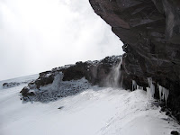
Overhang Bivy Site, with Rainfly Rigged as Tarp

We get as comfortable as possible in our cramped little space, and I set about trying to use my cell phone to call the rangers and various other parties who are expecting us to be down from the mountain. Much to our surprise, after several unsuccessful attempts, we get thru to the NPS Rainier climbing rangers at the Paradise Ranger station, and inform them that we are pinned down by the weather at about 12,200 feet on the side of Liberty Ridge, that we have enough food and fuel for the remainder of the climb, and finally, that we will not be off the mountain by our original exit day. The phone continues to cooperate, and we also reach the management at the REI where Dan and Hooman are scheduled to work the next day, and let them know that neither of them will be able to make it for their scheduled shift. Finally, I manage to reach my friend Elsa, and let her know that I probably won’t be able to bartend for her party in Puyallup on the 16th, part of the original plan for this visit to Seattle.

Jared, Hooman and Dan Happy to be Alive

The snow continues to fall as we huddle in our cave, visibility limited to our immediate rocky and snowy surroundings.

View from Bivy Site in Whiteout

After an eternity of shivering and waiting, the skies finally open up, visibility improves and we are greeted with stronger winds but also patches of blue sky.

View from Overhang with Improving Visibility

We pack up our gear, break down the improvised shelter, and begin the hardest climbing yet on the route, thru a 2-3 foot deep layer of very unstable, unconsolidated fresh snow that, when weighted, slides back downhill under body weight, making each step a struggle for balance, and making upward progress incredibly difficult and tiring. In addition to the crappy snow conditions, the wind quickly picks up, and eventually becomes yet another howling gale coming down the mountain straight at us, blowing all of the recently fallen snow down the hill in a steady river of snow. This surreal moving river of white is our nemesis and constant companion for the next 500 feet of climbing, and each step up is a battle against the wind, the loose snow, fatigue, and the cold.

Hooman Fighting the Wind and Blowing Snow

After several hours of struggling up against the wind and the cascading mass of snow that seems determined to prevent any upward movement, sometimes stopping every step to gasp for breath, I finally reach a tiny, exposed rocky ridge, the only flat ground visible anywhere on the ridge at this point. I drag myself up to the rock ledge, and quite literally collapse next to Dan in the shelter of a small boulder, completely and utterly spent. After several minutes to catch my breath, we discuss options, and despite the fact that I am more exhausted than I have ever been at any point in my life, I insist that we keep going up, mostly because I don’t want to stop here and freeze, and as difficult as the climbing is, it keeps us warm. Hooman and Dan convince me that finding the correct path at the top of the route would be impossible with the blowing snow limiting visibility, so we decide to bivy here at this extremely exposed but reasonably flat spot. I’m pretty much incoherent at this point in the trip, but manage to muster enough energy to agree, and Dan and I start to hack frozen rocks out of the ground to build a small wall to shelter us from the furious winds blasting us. After 30 minutes of building, we have a small wall that takes most of the edge off of the gale, and we all crawl miserably into our bags, and wait to fall asleep, an difficult prospect, since we are still be pummeled mercilessly by the wind and spindrift.

An Incoherent Jared Sacked up at Black Pyramid Bivy

The platform that we are perched on is nerve-wracking in and of itself, with a jaw-dropping 75 foot cliff only inches from our feet falling onto a slope littered with jagged volcanic rocks , with 3,000+ feet of exposure immediately beyond the initial cliff.

View From Edge of Black Pyramid

Thankfully, we are wedged so solidly into place by the rock wall and a large, immobile rock next to me that we often need to synchronize rolling over and sleeping positions in order to prevent elbows to the ribs, although being squeezed together this tightly certainly helps keep us warm. We are continually blasted by spindrift, and are forced to tighten the breathing holes on our sleeping bags to the smallest possible diameter to keep out the wind and snow. While checking the top of my bag for snow accumulation after some particularly fierce gusts, I make the unpleasant discovery that the sharp volcanic rock near my feet has ripped a two inch hole in the bottom of my down sleeping bag, and small clusters of down are attempting to escape. Thankfully, duct tape is handy, and the hole is patched as well as it can be, considering the circumstances. Also, at some point on the trip, Dan’s inflatable sleeping pad has developed a leak, so I end up lying on a snow patch with a thin, uninflated layer of nylon and foam under me, which turns out to be less uncomfortable than I thought it might be when the leak was originally discovered early in the evening. After several hours of huddling on our cramped little patch of flat real estate, it starts to get dark, and I don’t remember much after this point, so I think that I might have actually fallen asleep for at least a few hours that night

Night 4 - Steep and Dark, Into the Whiteout

June 14-15, 2007

Thumb Rock Camp (10,800 feet) to West Side Forced Bivy Site (+/- 12,000 Feet)

When we wake, we can see the bright lights of Seattle and Tacoma on the otherwise pitch-black horizon, and we start climbing in near-perfect conditions – not too cold yet, but cold enough for comfortably firm snow conditions. Hooman leads us out, setting the excellent slow-but-steady pace that he is so good at, and we make some serious progress. After an hour or two of climbing up some extremely exposed and often disconcertingly steep snow slopes, each of us immersed in our isolated bubbles of headlamp light, it starts to snow lightly. Not thinking much of it at this point, we continue up the ridge, stopping only for a short rest break on a rocky outcrop on the Willis Wall side of the ridge. After the rest break, it starts to snow harder and harder, until finally we can no longer see the lights of Seattle and Tacoma, leaving us alone in our shrinking circles of headlamp visibility.

After finally gaining the crest of the ridge, the snow is coming down pretty hard, but we continue along the boot tracks that we have been following for the night, leading us onto the right side of the ridge. We eventually lose this trail after it is covered surprisingly quickly by newly fallen snow, and Hooman and I are left wandering around on progressively looser 50-60 degree snow slopes, looking for the trail or a passable route up the ridge. By the time Dan catches up to us, we are in a full-on white-out, still in the dark, without a trail to follow, facing cliff bands that prevent us from continuing up the ridge.

We decide that we need to sit down and stay put until the snow lets up or it gets light enough out that we can see a route and continue up the mountain. We find a semi-sheltered spot next to a 6 foot cliff, dig out a small, flat snow platform to sit on, and get out the tent fly, our sleeping pads, and sit and wait for the light. We drape the tarp over our heads, and sit there, freezing our collective ass off, waiting for the snow to let up and/or for the sun to come out. Our platform is a 6 foot long by 2 foot deep shelf, perched above a 55 degree slope, with a 2,000 foot drop-off directly beneath our feet. Thankfully, the tarp blocks the view down into this abyss, although the snow effectively reduces our visibility to the point that all we see is vague outlines of dark rock outcroppings anyway. While we sit here, the snow continues to fall, working it’s way behind the rainfly draped over our heads, and onto our sleeping pads and gear. We sit and shiver, waiting for light and for the snow to let up.

Day 4 - Onto the Ridge, Thumb Rock

March 14, 2007

Carbon Glacier Camp (8,600 Feet) to Thumb Rock Camp (10,760 Feet) via Upper Carbon Glacier, Gully O' Death on east side of Liberty Ridge


Sunrise from Carbon Glacier Camp

The next morning we wake to slightly less severe winds, and a beautiful sunrise above the clouds, so we pack, and head up the glacier for the remaining 200-300 feet of hiking to the base of Liberty Ridge.

Carbon Glacier Camp

After a quick, uneventful slog up to the top of the Carbon, we start traversing along the western (right) side of the ridge to reach the base of the large snow gully that will eventually take us to Thumb Rock, 2000 feet above us.

Liberty Ridge at Sunrise, Right Side Approach Gulley

Along the way, we end up dodging some rockfall off of the ridge to our right, and traveling over some very disconcerting serac avalanche debris that has fallen from the ice cliffs along the top of Liberty Wall, 4000 feet above us to the left.

Final Approach to Base of Ridge

This semi-consolidated chunky ice, while relatively solid, gives the impression of walking on eggshells. Since we’re traveling around some serious crevasses, it takes us a while to navigate to the base of the ridge, where we're greeted with yet another frighteningly large bergschrund (crevasse or series of crevasses at the top of a valley glacier where a flowing mass of ice separates from a stationary mass of snow, ice, or rock), which we have to cross via a tiny, exposed, snow/ice bridge that takes us up onto the steep snow slopes of the giant gully. I start the climb up into the snow gully, with a slope averaging around 50-55 degrees, and am immediately greeted by the first of many rockfalls when a dinner-plate size chunk of rock comes whizzing by my head at high velocity. After a quick “ROCK!” scream from me, Dan, who has just crossed the uncomfortably tiny bridge over the bergschrund, looks up and has only a second to dodge this missile sailing directly towards his face. With a single, nerve-shreddingly well placed and timed rock, Mt. Rainier has officially welcomed us onto Liberty Ridge.

At this point, it is around 10:00 am, and we were told by the climbing rangers when we registered and bought our permits that we needed to be out of this gully by around 11:00 am, because the rockfall increases significantly after the sun has had a few hours to warm the slope and the rocks that had been frozen in place by the cold of the night get looser and looser as the day progresses. As we climb up the steep snow slopes, with more and more exposure and an enormous crevasse waiting for us at the bottom in the case of a mistake, we discover that even at this relatively early hour, we are basically in a shooting gallery, with rocks coming down at us every minute or two for the entire time we are in this gully. Since the majority of these rocks are falling from loose cliff bands near the top of the ridge, 1,500+ feet above us, they are usually traveling extremely fast by the time they reach us, so our eyes are pointed up for the majority of our time in this gully. Despite our collective vigilance, Dan is whacked in the leg by a good-sized chunk; thankfully the shell of his plastic boot takes most of the impact, and no harm is done. I get nailed on the top of my right hand by a fist sized rock that actually splits in half when it hits my hand and the top of the mountaineering axe that I am holding at the time, thankfully doing no damage to my hand but causing a lot of swearing.

Hooman Near Top of Gully O' Death

After half an hour of frenzied, high stakes dodgeball, and 1250+ feet of climbing, Dan and I take shelter under a solid-looking cliff, and grab a short break while we wait for Hooman to catch up to us after our adrenaline-induced, extremely inefficient sprint up the gully. (side note - It's during this break that Dan utters the phrase that sticks in my head for the rest of the climb, and accurately describes our experience on the mountain - "Dude - we're on Liberty Ridge - on the knife edge between life, death and bliss". Credit is due to Dan for the title of the blog - well said) Hooman, in his usual deliberate and unstoppable style, catches up to us, not even breathing hard, and we continue on up the gully. By this point, we are mostly out of the danger zone, so Dan and I slow down, but due to lingering exhaustion from our earlier effort spent getting up the gully as fast as possible, still have a hard time keeping up with Hooman.

Dan Approaching Thumb Rock

We finally reach the top of the ridge, where we find a beautiful, empty campsite waiting for us at Thumb Rock, with really, really, ridiculously good looking views of the Liberty Wall on one side, the horrifying bulk of the Willis Wall on the other side, and the Carbon Glacier, Seattle, Tacoma, and the Puget Sound area several thousand feet below us. The wind is still blowing, but previous occupants of this campsite have left us a decent rock wall, so we have a refuge for relaxing, cooking, and sleeping.

We decide that it would be a good decision to take a significant rest at this warm, comfortable campsite, and continue on up the route in the dark later that evening. After an hour, we are joined by a team of 2 from Utah that had been following below us for most of the morning. After food, conversation, and melting snow for water, Dan, Hooman and I all head to sleeping bags, and get some rest before getting up at 10:00 pm to continue up the ridge.

Sunday, July 15, 2007

Day 3 - Onto the Carbon Glacier

March 13, 2007

Edge of the Winthrop Glacier (+/- 7,200 Feet) to Carbon Glacier Camp (8,600 Feet), via Lower Curtis Ridge (7,200 Feet)

After a short nap, the horizon starts to get light, and we’re finally able to see the trail that had eluded us in the dark, only a hundred yards or so away from where we paused for a rest. We head out again, and while it's definitely getting lighter out, we’re still hiking in near - whiteout conditions, and we can’t figure out exactly where we are in relation to the beginning of our route.

Hooman in the Clouds

After another hour of hiking and more confusion about our position on the mountain, the clouds finally begin to open up for a few seconds every now and then.

Dan in Front of Willis Wall on Curtis Ridge

These brief moments of visibility finally let us determine exactly where we are, and we decide that in order to reach Curtis Ridge, and eventually the Carbon glacier, we need to continue across the snow slopes that we have been on after leaving the Winthrop Glacier.

Dan and Hooman, Willis Wall

Finally, after more cloud-induced hide and seek with the mountain, we reach Curtis Ridge, and are abruptly stopped in our tracks by a 200+ foot sheer drop down to the surface of the Carbon Glacier, the last obstacle in the approach to the actual climb on Liberty Ridge.

Liberty Ridge Route

After a bit of scouting past a couple of ridge-top campsites with dynamite tent sites and absolutely astounding views of the Willis and Liberty Walls, bisected by Liberty Ridge, we find a route down to the Carbon Glacier, rope up, put on our crampons, and start our trip across the violently crevassed, nerve wracking trek across the Carbon Glacier. We reach the first of the major icefalls on the Carbon, to be greeted by 100+ foot crevasses on all sides, with enormous seracs directly to our right and left, several of which collapse while we are in the icefall.

Icefall on Carbon Glacier

A quick, blood-pressure raising jaunt up this icefall takes us up and over a thin, steep patch of snow, around some truly frightening crevasses, all of which are bordered on either side by more huge areas of overhanging seracs.

Seracs on Carbon Glacier

A bit of zigging and zagging to avoid more crevasses, and we finally end up on a slightly less steep patch of snow, and continue up the glacier. After another 300+ feet of climbing, we are getting close to the base of Liberty Ridge, and the glacier starts to flatten out.

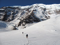
Dan, Hooman on Upper Carbon Glacier

At this point, it’s about 11:00 in the morning, and Hooman suggests that we again wait until dark to start the ascent of the actual ridge, to minimize the rockfall/icefall hazards we’ll be facing, so we find a semi-flat spot on the glacier, put down our tent rain fly, get out the sleeping bags, and start to melt snow for water. We all eat some food, sort gear, and just generally try and relax.

Fearless Visitor

Dan builds an excellent tiny windbreak wall to protect the stove while we melt snow, and we are visited by a fearless LBB (little brown bird), who apparently finds all sorts of interesting things to eat and/or peck at around our campsite, at times only inches away from our sleeping bags.

Dan's Cooking Wall

While we are lying here napping at this campsite, I make the unpleasant discovery that the shell fabric of my new sleeping bag is extremely slippery, and the spot that I picked for our campsite is slightly tilted. The combination of these two factors means that despite the ridges on closed-cell foam sleeping pad, when I am in my sleeping bag, even lying perfectly still, I will slowly creep downhill until I slide off my sleeping pad, off the tarp and into the snow at my feet, which, of course, will eventually melt and get the down insulation in the foot of my bag wet.

View from Campsite

Unfortunately, there’s not really all that much I can do about this phenomenon, so after much swearing at myself for picking a campsite on a hill, I just grit my teeth, and continually haul my pissed-off self back up the hill onto the sleeping pad after every slide, adding an unwelcome workout to the whole nap situation.

Carbon Glacier Camp

While we are perched at our hill-side campsite, the wind continues to pick up all afternoon, until we are dealing with a full-blown gale coming up off of the Carbon glacier, blasting us with spindrift (loose snow) that is extremely effective at finding it’s way into any small opening in a jacket or sleeping bag breathing hole, and blowing away anything in camp that isn’t quite literally tied down, as Dan soon discovers as his foam sitting pad is sent flying across the glacier by a gust.

This afternoon, Dan and I both make the unfortunate but inevitable discovery that we must answer the call of nature, and get acquainted with the phenomenon of the dreaded "Blue Bag". Basically, on a heavily trafficked peak like Rainier, the National Park Service makes climbers pack out their own waste, and in order to do this, they provide climbers with small, durable blue plastic bags. I won't go into details, but suffice it to say that it is a new and not entirely pleasant experience for both of us. Enough said.

Sunlight on Ridge over Carbon Glacier

The wind gets stronger over the course of the afternoon, and we decide that it would be a bad idea to try and climb in these conditions, so we decide that instead of beginning our climb later that night, it would be smart to stay at this windy campsite, and get up early the next morning to start up the ridge. At some point late this evening, I am sitting in my sleeping bag but still freezing, so I decide that it’s time to get out and do something to warm up.

Sunset Over Carbon Glacier

It’s already past sunset, and it’s starting to get even colder out in addition to the already howling wind, but I get out of my sleeping bag, pile on the layers, and go to town building what was originally intended to be a very small, half-assed snow wall to block at least a tiny bit of the winds that are apparently trying to blow us off the mountain. More importantly, this alpine construction project is intended to serve as physical labor to warm me up and wear me out enough so that when I get back into my sleeping bag, I will actually be warm enough and tired enough to fall asleep, downhill slippage be damned. After an hour and a half of grunting, swearing, excavating, hauling, hands-on lessons in snow physics, and surprisingly hard work, I end up completing a semi-respectable 12 foot long, 3 foot high wall of snow blocks, cemented together by the slightly wetter layer of snow that was consistently found 2 or 3 inches under the crusty surface layer that made great blocks after some patient and careful quarrying. All this masonry work has achieved its desired purpose, so comfortably warm and vaguely weary, I slither back into the slippery confines of the sleeping bag, and head off into a surprisingly decent night’s sleep.

Night 2 - The Approach to Carbon Glacier

June 12-13, 2007

Glacier Basin (6,200 Feet) to the Winthrop Glacier (+/-7,200 feet), via St Elmo Pass (7,400 Feet

We set off from our cozy Glacier Basin campsite in the dark. To travel light, we leave the body and poles of our 3-person mountaineering tent to be picked up on the return trip, bringing with us only the rain fly and the tent footprint tarp, both of which we can wrap ourselves in or use as tarps in a worst-case scenario. Passing 6 or 7 tents occupied by snoring trekkers and climbers, we head out in the dark across the broad, snowy expanse of Glacier Basin and cross the White River. We traverse up towards what we think is the trail to St Elmo’s pass, looking for a set of switchbacks that we could see leading to the pass when we arrived in the basin earlier that afternoon. After some uncertain boot track following, we find what we think are the switchbacks, and gain the top of St. Elmo Pass. We immediately start the descent to the Winthrop glacier, quickly losing several hundred feet of the altitude we had just gained, finally reaching the surface of the Winthrop feet below the pass.

The traverse across the Winthrop glacier in the dark is nicely straightforward – with each of us comfortably ensconced in his own little bubble of headlamp illumination, we follow a well-defined boot trail across the glacier, which has enough snow cover that we feel comfortable not roping up for the first half of the traverse. After an hour or so, we finally start to encounter some crevasses and sketchier looking terrain, so we get out the rope, and continue until we finally hit some truly gnarly crevasses and holes, and lose the boot path in the dark.

Short Bivy on Winthrop Glacier

At this point, it is only an hour or so until it starts to get light out, and it’s getting foggy out, reducing visibility even further, so we pause for a mini-bivy, get out our sleeping pads, have a seat, and relax for a while.

Day 2 – Beta, Permits, the Approach to the Approach

June 12, 2007

Enumclaw, WA to Glacier Basin Camp (6,200 feet) via White River Ranger Station

We get up early, and following a quick involuntary sight seeing detour to Chinook Pass after driving past our turnoff to the White River entrance, head to the ranger station to buy our climbing permits, and get some great info about route conditions, route finding, and all kinds of assorted info that will become extremely important, if not downright life-saving, later in the trip. On our official climb registration, we estimate that the climb will take us 3 days at minimum, with an extra day added for any problems that might arise.


Dan and Hooman Packed Up at White River Trailhead

Fully permitted and ready to go, we head to the trailhead and after an hour of the classic pre-climb parking-lot-filling gear explosion, we're finally packed and ready to go. The first two hours of hiking are pretty simple, following the impressively re-landscaped White River trail. The flood damage here is truly epic and ridiculous – the first 2 miles of the trail have been completely obliterated, and the trail now winds thru heaps of uprooted trees and enormous bare rock gardens scoured clean by the rampage of the White River last November.

Hooman and Dan - the Heroes at Glacier Basin

We reach Glacier Basin Camp at around 2 or 3 in the afternoon, and proceed to set up the tent, boil water, and have some food. We decide to take an afternoon power nap, and continue on the approach starting later that evening once it starts to get dark and snow conditions improve a bit.

Day 1 - The Drive

June 11, 2007

Seattle, WA to Mt. Rainier National Park via Enumclaw, WA

After forgetting to change my watch to Pacific Time flying in from Juneau, I am picked up by the guys at the family condo instead of meeting at REI as originally planned. After greetings, apologies from me, and assurances that I’ll carry the rope for the trip, we head toward the mountain, stopping at the Tacoma REI for sporks and stove gas, and an excellent pre-climb lunch provided by Quizno’s. After some truly heinous suburban Seattle/Tacoma traffic, we finally arrive in the park exactly 25 minutes after the climbing permit office has closed for the day. We track down some extremely helpful rangers, who inform us that we’ll need to drive all the way around the park to get to the White River entrance, since the road that we would normally be able to take thru the park was thoroughly obliterated in several spots by the floods of November 2006. We drive almost all the way around the mountain, and after a bean-erific Mexican meal and some grocery shopping, head into the park to find our entry point at the White River campground, only to discover that the campground hasn’t opened for the season yet. We backtrack to Enumclaw, find a motel and crash for the night.

Liberty Ridge Intro and Route Description

The Team

Dan Holz – Manages the flagship Seattle REI climbing department, very experienced climber and all-around adventurer. Summited Rainier via Ingraham Glacier (and D.C.?)

Hooman Aprin – Another REI cohort – runs the climbing pinnacle at the Seattle REI. Former Exum guide, Guided on Everest, in the Himalayas, first ascents in AK, and all over the world. Summitted Rainier via Ingraham and Emmons Glacier routes, probably more

Jared Carlson
– if you’re reading this, you probably already know me. If not, I run around on glaciers in Juneau, AK making sure cruise ship passengers don’t fall into crevasses. I commute to work in a helicopter. Never set foot on Mt. Rainier before


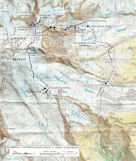
The Objective – Liberty Ridge, North Face of Mt. Rainier


(Click on image for full size map)

Route Description from "Mount Rainier – A Climbing Guide", by Mike Gauthier, lead climbing Ranger for Mt Rainier National Park


"Featured in Fifty Classic Climbs of North America (by Steve Roper and Allen Steck), Liberty Ridge is truly the celebrated mountaineering classic of Rainier. The 5,500 foot ridge splits the steep north faces of Willis Wall and Liberty Wall, providing moderately difficult and protected climbing to the summit. This committing climb can only be accessed by crossing the jumbled ice and crevasses of the 900 foot deep Carbon Glacier.


The exposed ridge challenges climbers with moderate to steep ice climbing and a perched bivy at Thumb Rock. Willis and Liberty Walls are the backdrops that provide a constant showcase of ice avalanches and rockfall from the summit ice cap. Since the climb is so long and committing, climbers must plan their trip well, usually needing to carry their gear to the summit and descend another route.


Elevation Gain
– 9,700 feet from White River Campground to Liberty Cap


What To Expect
– Rockfall and Icefall hazard; 55-degree ice slopes; Glacier Travel; Grade III or IV


Time
– 2 to 4 days; most parties need 2 days to reach the Thumb Rock high camp (10,760); 5 to 10 hours from high camp to Liberty Cap. Carry Over to Emmons Glacier for descent


Season – May to mid-July


First Ascent – Ome Daiber, Arnie Campbell, and Jim Borrow; Sept 30, 1935


Intermediate Camp – Lower Winthrop Glacier (7,200 feet), lower Curtis Ridge (7,200 feet) or Carbon Glacier (7,200 - 8,500 feet)


High Camp – Thumb Rock (10,760 feet)


Liberty Ridge can be gained on the Willis Wall side (east) or the Liberty Wall side (west). Climb the west side of the ridge crest ascending moderate snow and scree slopes (30-40 degrees) to Thumb Rock (10,760 feet), a large gendarme composed of questionable rock. The saddle just on the uphill side of this rock formation provides an excellent high camp. The area is small, however, and can be crowded on busy weekends. Also note that falling rock from Thumb Rock is possible.


From Thumb Rock, choose on of three short variations to gain the ridge above the rock face behind camp. The east face variation on the Willis Wall side is a moderate snow slope staying close to the rock. It gains the ridge 400 feet above the camp and is exposed. The right center gully is the steepest variation, having a 15 foot ice pitch (70-80 degrees) in a narrow gully that runs out onto the ridge directly above the rock. The west face variation on the Liberty Wall side is also a moderate snow slope with exposure.


Once the ridge crest is regained, ascend 40 to 50 degree snow and ice slopes to the base of the Black Pyramid at 12,400 feet. Then traverse towards Willis Wall and climb the open face. This is the steepest part of the climb, sometimes 55 degrees. It runs for three or four rope lengths, and can be hard and icy, particularly near the top of the Black Pyramid. Climb to the crest of the ridge above the Black Pyramid, where the slope angle decreases and the route joins the Liberty Cap Glacier at 13,000 feet.

From there, ascend moderately steep glaciated slopes toward the bergschrund directly above. Depending on the year and season, the bergschrund may require a short section (10 to 40 feet) of vertical ice climbing to surmount, or it may simply involve end-running the obstacle. Above the bergschrund, the rout continues on the glacier for the last few hundred feet of elevation gain to Liberty Cap.

Descent – Carry over and descend the Emmons/Winthrop Glaciers route to Camp Shurman."

The Verdict

March 22, 2007

I have some unfortunate news to report - I unexpectedly received a letter from Eastman telling me that I was not accepted into the grad cello program. It came as quite a shock, as I was expecting to see some sort of paperwork related request or other problem when I opened the disturbingly thin letter that I found in the mailbox on an otherwise uneventful Sunday morning.

Sooooooo. After more than a year of my life spent preparing for both this and last years auditions, as might be expected, I am still in shock over the whole thing, and have been doing some serious thinking about my future endeavors. The options that remain to me at this point are A. Attend University of Colorado Boulder, which is almost definitely not going to happen, since I wasn't all that impressed with the school, it's expensive, and it has a reputation of being a huge party school. B. A less likely option - save myself $45,000+ in grad school costs, and pursue other facets of my life, ie climbing, that have had some very promising developments in the recent past. Or pursue something completely different. Who knows

I definitely haven't made up my mind as to where I am going to be and what I am going to be doin after this coming summer up in Juneau, but I do know that I won't be attending Eastman next year, and unfortunately, I don't think I can stand putting myself through another year of preparation and auditions for the same program. There is a fine line between dedication/commitment and stubbornness/stupidity, and I think a third year of auditions for the same school would be edging dangerously close to that line, if not crossing it.

So that's it! Thanks for all of your support through this whole process, and take care

The Audition Fiasco (Postscript)

Some of you already know how this story ends, but I just wanted to let everyone know that after minimal additional drama, my cello and I arrived back in Seattle in one piece the day after the audition.

After the involuntary layover in Chicago, my cello finally made it to Rochester on the incoming plane that I returned to Chicago on less than an hour after it arrived. After opening the cello case in Seattle (one of the more harrowing moments of the trip...) I discovered that the instrument was not only intact, but it was still basically in tune after spending an entire day and night in the unheated baggage purgatory at Chicago's O'Hare. Apparently, my flight case did the job it was designed to do, to say the very least.

So I now await the results of the audition from the powers that be in Rochester, which should arrive sometime around the beginning of April. In regards to my own perception of the audition and my thoughts about my chances of getting accepted to the program, I remain quite squarely on the fence - there are a lot of factors in my favor, but the unfortunate reality remains that all things considered, I didn't play my best, and ultimately, how you play is the single biggest determining factor in admission to these places. I can only hope that all the other factors in my favor outweigh the playing aspect, and that the professors recognize my sincere interest in attending this great school, and my determination (stubbornness?) in auditioning a second year.

Thanks for the encouragement and kind words from everyone. I'll keep you posted, and for those of you in the Pacific Northwest, you should be able to hear me yelling for joy or swearing profusely sometime around the beginning of April, depending on the contents of mail from the East coast.

The Audition Fiasco

The post-disaster briefing composed in the lobby of the Rochester Crowne Plaza Hotel

Mar 2, 2007 4:29 PM

Hello all

For those of you that have been tracking the preparations for my latest round of grad school auditions (this time only one audition), I wanted to let you know that as of approximately 60 minutes ago, I am done with my audition, thus concluding a chapter of my life that has ended in what can only be described as one of the most unbelievably intense disaster recovery efforts that I have ever experienced.

We begin with my flight from Seattle to Chicago being delayed about 3 hours, thus causing me to miss my first possible connecting flight from Chicago to Rochester by a good solid hour. Not a good start, but nothing compared to the crapstorm to come. I arrive in Chicago to Arrival/Departure boards with nearly solid yellow "Cancelled" next to the vast majority of flights out of Chicago. By now it is 3:00 in the afternoon, and I was supposed to be on the 1:30 flight to Rochester, getting into town in the early afternoon, thus leaving me lots of time to play a bit, shower, and get a good nights sleep. But hope springs eternal - there are still two flights tonight going where I need to go. After an hour wait, during which I managed to make myself sick snarfing down an enormous Cinnabon too fast, the first flight is canceled, to the groans and profuse swearing of me and my fellow travelers. We all make a beeline for the dreaded red "rebooking" phones, and I manage to finagle a spot on the last flight to Rochester of the day, leaving in two hours.

I wander aimlessly for yet another two hours, and after finishing the book that was supposed to last me another couple of weeks of reading, I head back to the gate to find the ominous but by now predictable yellow "canceled" that the gate agent had neglected to announce, thus further enraging me and my fellow travelers. So, that's it for the night. No more flights to Rochester or anywhere even near it.

I head to the nearest hotel, which is, of course, due to the crappy weather, booked solid (impressive, considering the ridiculously high room rates...) I head out to the front counter after spending more time on the red rebooking phone, and somehow manage to book a seat on the first flight out in the morning after being told by the ticket agents on the phone only minutes before that the flight was full. Gotta love electronic check in! I finally get a return call from someone at the Eastman admissions office after leaving them a message saying there's no way in heck that I'm going to be there for the beginning of the day tomorrow.

I head back to the depths of the G concourse at Chicago O Hare airport, and after walking around in shock for a while, find a relatively quiet spot, and engage in the time-honored tradition of trying to sleep in a bright, freezing, noisy airport, complete with blaring announcements every 2 minutes about the national terrorism threat level being raised to "Orange" (run away!!!) Thankfully, being the semi-savvy airline traveler that I am, I came prepared with ear plugs and a hat that blocks light very well when pulled down over the eyes and used as a sleep mask. Sleep commences, interrupted by the occasional janitor loudly emptying garbage cans nearby.

I wake to freezing cold air finding me from an open door with lots of baggage workers trucking by me at 4:30 am, and decide to go stake out a spot by the gate that my 9:25 am flight is supposed to depart from. Keep in mind that I was supposed to be AT EASTMAN at 9:00 am for the beginning of the audition day convocation, where they talk about the school, the audition day, and hand out schedules. Not gonna happen. After much anxiety and much CNN watching, our flight finally leaves. I was told by the gate agent that I talked the night before that my cello would be on that first flight to Rochester even if I wasn't on it, so it seemed logical to think that since I was, in fact, on the flight, that my cello would most definitely be on it as well. Hmm. In any case, my flight ends up leaving with me on it, and how I got an actual seat is still a mystery to me, since the gate agents all swore up and down that the earliest available spot for me to get to Rochester was today at 4:00 pm

Upon my arrival in Rochester, the nightmare continues, and I discover to my extreme horror that my cello has not accompanied me, meaning that is floating around in the freezing hell that is the O'Hare luggage department. The fact that I need to play it in approximately 3 hours notwithstanding, the simple idea that it's lost in the baggage area, in the cold, being tossed about by knuckle-dragging, poo-tossing baggage monkeys who wouldn't know an expensive string instrument if it hit them in the face, is horrifying enough in and of itself. So, after several simultaneous minor heart attacks, I find the shuttle to my hotel, and proceed to shower, shave and iron my clothes faster than I ever thought possible. I honestly don't think I could have done it any faster if there had been a gun to my head.

I walk to the Eastman Admissions department, who have already been informed that I will be late, and that I will be severely lacking in the cello-to-play-on department. They talk to the cello professors who I was supposed to audition for at 12:00 noon (It's now 3:30 pm) and I am conveniently outfitted with a very nice cello, which, despite it's excellent quality, is still most definitely not the cello that I have been playing on for the last 2 years.

After getting an excellent, rather unexpected warm-up, I play an audition that was described by Alan Harris, the professor that I want to study with, as "making lemonade out of lemons". During the audition, I begin with numerous strange fingers-going-the-wrong-way incidents but manage to pull together a respectable performance of the Allemande from the 6th Bach Suite, play a good-to-excellent rendition of the Bach Courante, and then proceed to crash head-first into a very solid brick wall when I attempt the first movement of the Dvorak concerto, beginning with some decidedly un-cello like sounds that could have been mistaken for a duck being strangled, and can probably be attributed to my lack of sleep, frazzled state of mind, and just maybe the fact that I am playing on a completely unfamiliar cello. Coincidentally, my sub-conscience picks this particular piece to decide that I am now unable to play the shifts that I have worked so hard on over the past 6 months. I finish with my ludicrously hard etude, which goes reasonably well, but still contains many mini-train wreck moments that are both obvious and infuriating.

I am still not entirely pleased with my performance, even considering the circumstances, but one inevitable fact that is true, regardless of everything that has happened -

I am

DONE.

And now, I am going to go call American Airlines, try to find Trinity (my cello), and then watch TV, get a large quantity of food via room service (I just realized the only thing I've had to eat yet today is a single orange), and sleep for 16 hours straight. My flight tomorrow, if it ends up leaving at all, is scheduled to head to Chicago at 4:30 in the afternoon, so I've got lots of time to do Absolutely Nothing all morning.

And that, folks, concludes the monumental clusterf@#k that was my audition.
(pardon my french, for those of you with sensitive ears)

Don't check your precious cellos as baggage on American Airlines flights.

Saturday, July 14, 2007

It Begins.

Hello All

If you're reading this, you've either stumbled across this corner of the internet at random, or you're someone who is, in some way shape or form, acquainted with the random collection of interests and pursuits that make up my life. In any case, this blog is intended as an ongoing record of the dangerous, ridiculous, pointless, sublime, beautiful and sometimes entertaining occurrences that make up my somewhat unusual life. stay tuned.

Enjoy

~Jared, Jed, J-Rod